Preface
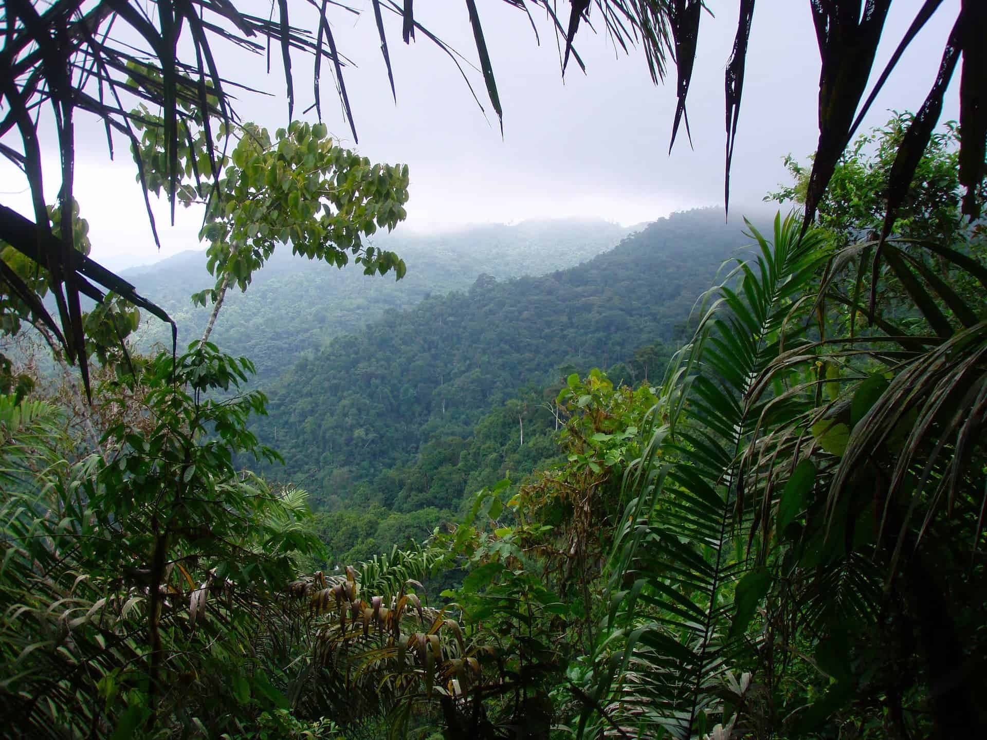
In coastal Ecuador, at zero degrees latitude, a few kilometers inland from the Pacific Ocean, on a densely forested mountain range shrouded in fog, is one of the most extraordinary and vulnerable ecosystems on planet Earth – the Pacific Forest of Ecuador. Future generations may never get a chance to see it. Hopefully they will.
For a brief visual synopsis of this article, you can also take a quick photo tour of Pacific Forest of Ecuador.
Contents
- An Unidentified Forest
- A Rainforest Preserve is Born
- The International Community Weighs In
- Defining an Ecoregion that Defies Definition
- At the Nexus of Mountains and Sea
- The Mountain Ranges
- Chocó Rainforest & Premontane Cloud Forest
- Moist Evergreen Forest
- Tropical Deciduous Forest
- Global Biodiversity Hotspot
- Conservation Priorities
- Final Analysis
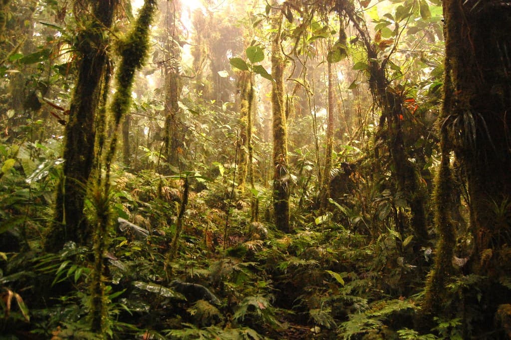
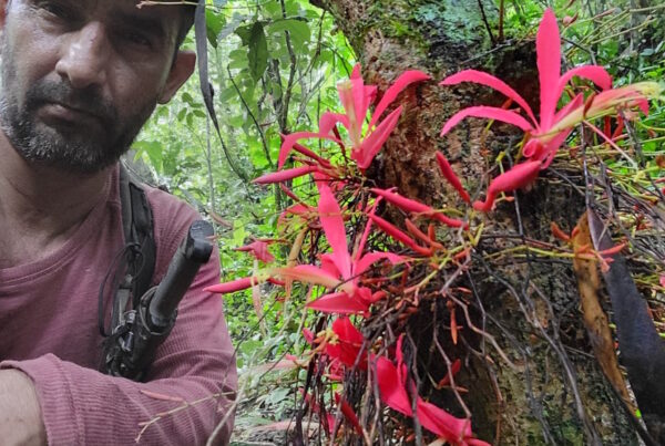
The cloud forest of the Jama-Coaque Reserve on the Pacific Coast of Ecuador, province of Manabí.
An Unidentified Forest
In the year 2007, a few newly-hatched rainforest conservationists stepped foot inside the Pacific Forest of Ecuador without knowing anything about it. We had devoted much of the year to exploring every tract of wilderness we could find in Ecuador—from Amazon to Andean cloud forests, and everything in between. But this impromptu expedition to the Pacific coast was somewhat of an outlier. As far as we knew, none of the forest was left.
As it turns out, we were wrong. Nothing we had seen in the entire country compared to what we saw that day. On the crest of Ecuador’s coastal mountain range, about midway between the towns of Jama and Pedernales, we found ourselves in a cloud forest that had never been surveyed by science. Surrounding us in all directions was a sea of deforestation.
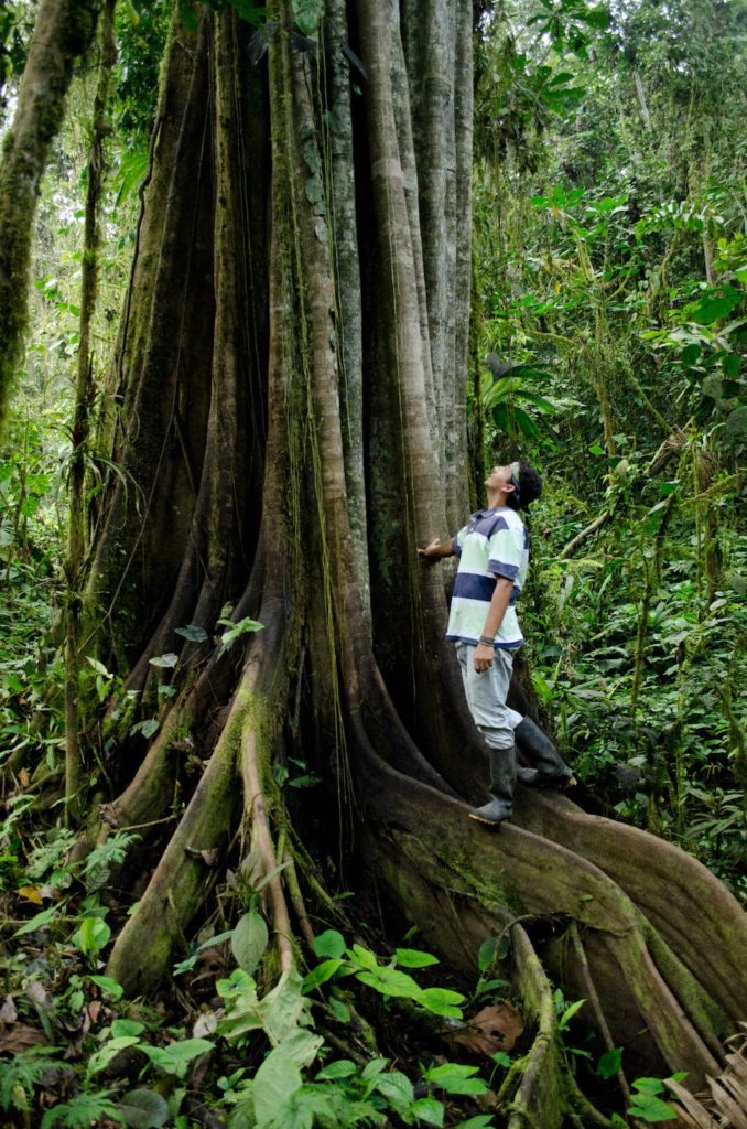
Strangler Fig (Ficus sp.) in the Jama-Coaque Reserve.
A Rainforest Preserve is Born
From that very first day, it was apparent that this forest was desperately in danger of entirely disappearing—probably in the next generation, possibly even in a single decade. Even as novice conservationists—which is what we were at the time—we recognized that the conservation value of this cloud forest was higher than anything we had ever seen.
We then hiked back down the mountain, hitched a ride on the back of a truck loaded with sacks of passionfruit, and began a full-time career in rainforest conservation. The first thing we did was create a nonprofit organization (TMA), raise $16,000, and purchase 100 acres at the top of that mountain. This is how the Jama-Coaque Reserve (JCR) was born. Our mission: keep this forest alive.
In our lofty hopes of generating global awareness, however, we faced a few key obstacles. To begin with, nobody really knew what to call this forest. The people who lived in its shadow simply referred to it as “the mountain.” Most Ecuadorians weren’t even aware of its existence.
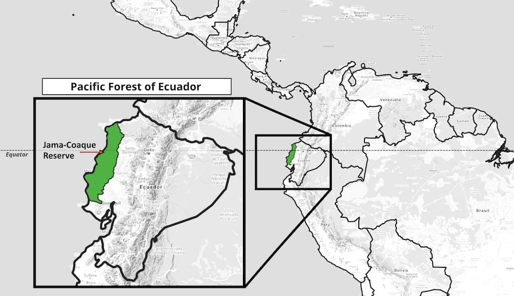
We used satellite imagery to identify every single large tract of remaining forest in the PFE, and we ground-truthed this data by hiking through the majority of them. The natural range of the Pacific Forest of Ecuador covers 22,835 square kilometers. As of 2021, only 510 square kilometers of this forest are still intact. That’s 2.23%.
The International Community Weighs In
Shortly after the birth of JCR, we learned that the Critical Ecosystem Partnership Fund (CEPF) designated this region as the most threatened tropical forest in South America. They referred to it as the Chocó-Manabí Corridor—an ecoregion that connects the Chocó rainforest of coastal Colombia with the Pacific Forest of Ecuador, particularly in the province of Manabi.
It was an exciting turn of events, but CEPF’s proposal for a large-scale project to save this forest from extinction never came to fruition. The dream of a grand Chocó-Manabi Corridor was temporarily shelved. Once again, the Pacific Forest was largely forgotten.
In fact, the entire ecoregion was so far under the radar that ecologists hadn’t fully agreed on what to call it. The famous botany duo of the previous century—C.H. Dodson and A.H. Gentry—referred to it as the “Forests of Western Ecuador.” Their seminal paper “Biological Extinction in Western Ecuador” (1991) is largely responsible for putting this ecosystem on the global conservation radar.
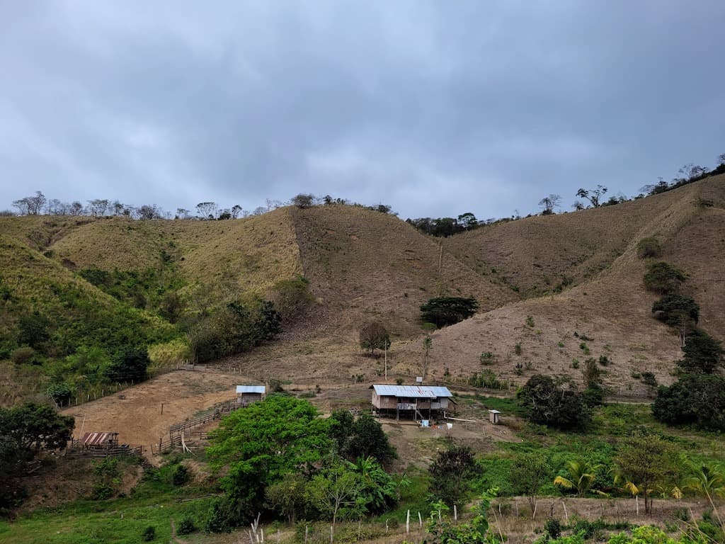
As much as 98% of the Pacific Forest has been lost in just one century. Most of it has been converted to marginally-productive cattle pasture. Almost the entire ecosystem has been sacrificed to feed cows.
Defining an Ecoregion that Defies Definition
The Pacific Forest of Ecuador is not an easy ecosystem to classify, owing to the fact that it has so many different faces. Various names have been affixed to it, over the years, but none of them really stuck.
One of the most promising attempts came from the World Wide Fund for Nature (WWF), who originally referred to it as the “Moist Forests of Western Ecuador.” The problem with this term is that it’s too broad and also too limiting. It aims to cover the entire western lowlands of Ecuador but restricts itself to only one of the many kinds of forest that are found in its range.
The western coast of Ecuador is, in fact, home to six different types of tropical forests. Chocó lowland rainforest, Chocó premontane cloud forest, moist/seasonal evergreen forest, semi-deciduous forest, tropical dry forest, and mangrove forest can all be found in the Pacific Forest of Ecuador. In one particular area—in the northwest of the province of Manabí, between Jama and Pedernales—all of these forests can be encountered over the course of a single day’s hike.
In this sense, the Pacific Forest of Ecuador can best be described as a melting pot of tropical forests. As C.H. Dodson and A.H. noted in “Biological Extinction Extinction in Western Ecuador,” coastal Ecuador harbors 12 distinct Holdridge life zones. The two factors that drive this ecological diversity are the Pacific Ocean and the coastal mountain range.
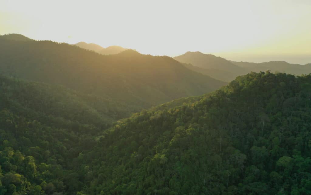
The Jama-Coaque Cordillera extends from the town of Jama and crosses the equator en route to the town of Pedernales, with views of the Pacific Ocean (top right) visible from the peaks.
At The Nexus of Mountains and Sea
Almost all of the remaining forest in western Ecuador is isolated to the peaks, slopes, and foothills of the coastal mountain range, which runs parallel to the Pacific coast for over 300 kilometers. This low-lying mountain range is the backbone of the Pacific Forest of Ecuador. The ecoregion, as a whole, is thus bounded by the Pacific Ocean and the eastern foothills of the coastal mountain range, from Mache-Chindul in the north to Chongon-Colonche in the south.
This long, narrow stretch of mountainous land contains the widest diversity of tropical forests in South America. It’s also the most threatened.
For these and other reasons, the Pacific Forest of Ecuador often draws comparisons to another one of the world’s great tropical forests: the Atlantic Forest of Brazil. Both forests are overshadowed by their much larger counterpart, the Amazon, but the Pacific Forest and the Atlantic Forest are actually more ecologically diverse, more threatened, and have higher rates of endemism.
The forest diversity of the Pacific Forest actually exceeds that of the Atlantic Forest, despite the fact that the Atlantic Forest covers 33x as much area. In any event, both ecosystems are under immense threat. Approximately 8% of the Atlantic Forest still remains and only 2% of the Pacific Forest remains. Together, they contain more endemic species than anywhere else in the world.
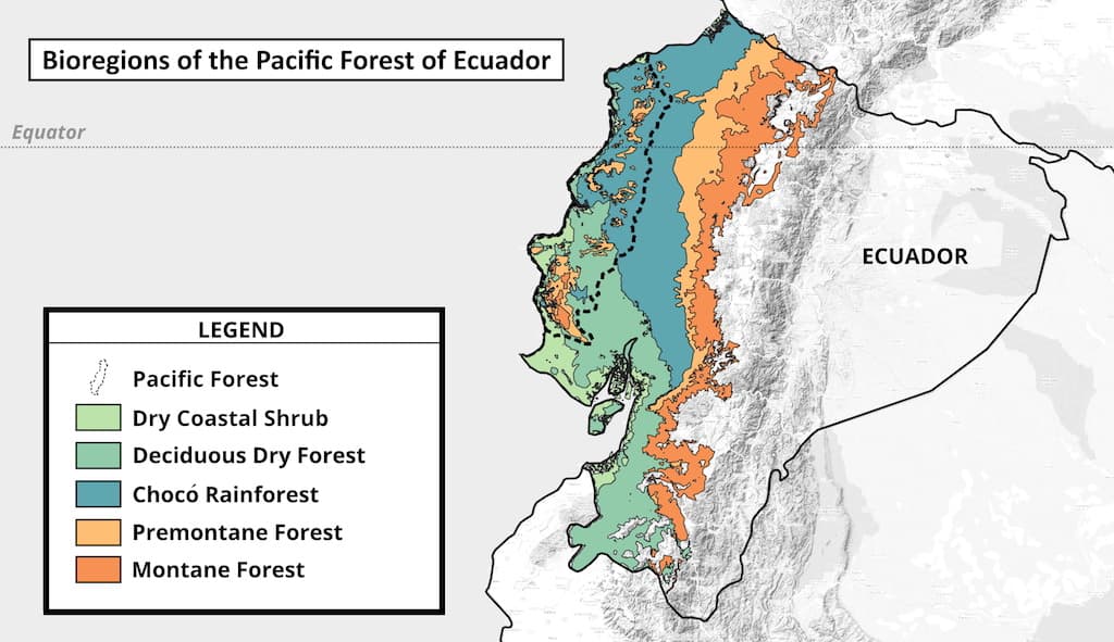
The Mountain Ranges
Across the entire length of coastal Ecuador, there are three major mountain ranges. The Mache-Chindul mountain range occupies the northern coast. It’s primarily located in the wet province of Esmeraldas. The Chongon-Colonche mountain range, on the southern coast, stretches from the southwest corner of Manabí into the dry provinces of Santa Elena and Guayas. The Jama-Coaque mountain range is located in between the two, located in northwest Manabí province. Ecologically, it is the transition between the two extremes.
None of these three mountain ranges are as tall as the Andes mountains, all run parallel to the Pacific Ocean, and all are host to a wide array of forests that have been badly fragmented. But the vegetation contained on the northern and southern ranges is, in some cases, diametrically different. The central mountain range contains elements of both.
There are two key gradients that define vegetation in coastal Ecuador. As a rule of thumb, as you move from north to south, and from mountaintop to beach, the overall level of precipitation decreases. As a result, the forest goes from wet to dry. Generally speaking, most of the forest along the Mache-Chindul mountain range is rainforest or moist forest, and much of the land along the Chongon-Colonche mountain range is either dry forest or semi-deciduous forest.
The Jama-Coaque mountain range is the centerpiece. It is distinguished by two factors: 1) its location at the mid-point of the wet-dry gradient that runs from north to south and 2) its unusually close proximity to the ocean. It is the only stretch of the coastal mountain ranges where the peaks reach their zenith within a mere 8 kilometers of the sea. This means that the wet-dry gradient is compressed into an extremely small area.
Let’s start with the wet part.
Chocó cloud forest in the Jama-Coaque Reserve.
Chocó Rainforest & Premontane Cloud Forest
Not long after the creation of JCR, a team of botanists was tasked with creating Ecuador’s national vegetation map. As part of their research, they visited our newly-established forest preserve to conduct a botanical inventory. In the cloud forest along the peaks of the cordillera, they were delighted and amazed by what they saw: premontane cloud forest. It was the southern-most coastal extension of what the Regiones Naturales de Ecuador classification system by Pontificia Universidad Católica del Ecuador (PUCE) classifies as Bosque Húmedo Tropical del Chocó (Chocó tropical rainforest).
It was something they had never seen this far south and this close to the ocean. Before they arrived, they didn’t believe it existed. And yet, here it was. It changed the way they mapped and classified the vegetation of western Ecuador.
The great Chocó rainforest runs along the Pacific coast of Colombia and extends into northwestern Ecuador, bounded by the western slopes of the Andes and the peaks of the coastal mountain range. The Colombian Chocó is among the wettest rainforests on earth. It competes with the upper Amazon as the most biodiverse place on earth. As the Chocó moves southward into coastal Ecuador, it gradually transitions into the moist evergreen forest of Manabí until it is eventually subsumed by the dry forests of Santa Elena and Guayas.
The Jama-Coaque Reserve is the geographic and ecological midpoint between those two extremes. Depending on where you stand on the mountain, you will see different faces of the Pacific Forest. At the top of the mountain, it’s the Chocó. And 20 km further to the north, at the top Cerro Pata de Pájaro, the Chocó is on full display.
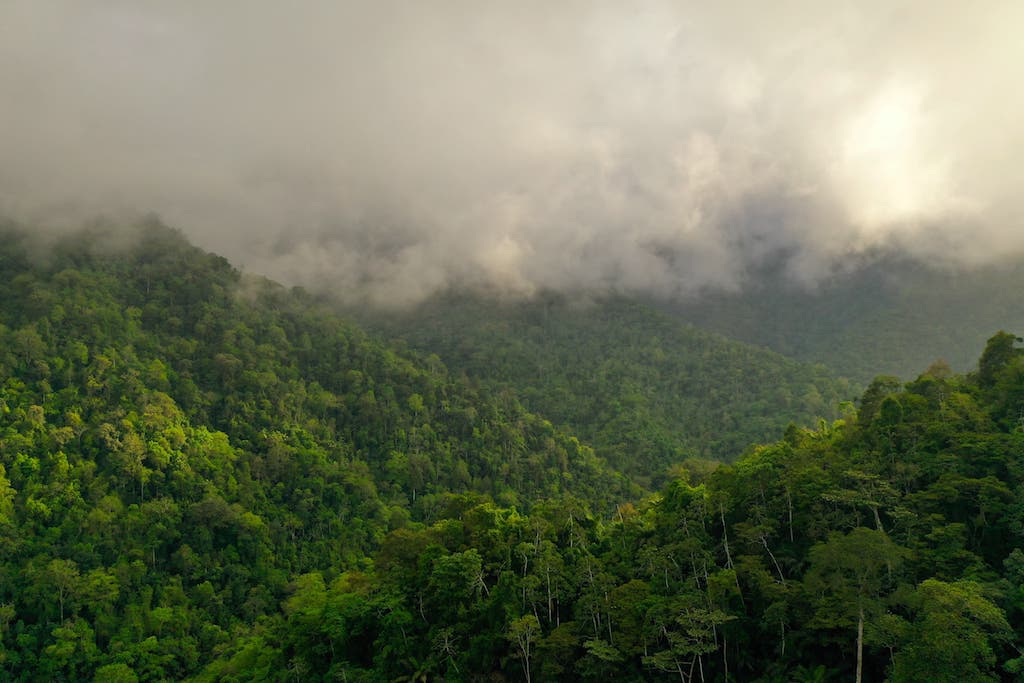
The daily shroud of clouds on the peaks of JCR
The cloud forest in the Jama-Coaque Reserve is the southern-most extension of Chocó rainforest vegetation along the coast of South America. Although this particular stretch of the coastal cordillera only rises 600-700 meters (2,000-2,300 feet) above sea level, its close proximity to the Pacific ocean accounts for the thick blanket of fog that descends upon the forest nearly every single night of the year. It is, in a very real sense, a forest that is fed by the clouds.
What does this unlikely cloud forest look like?
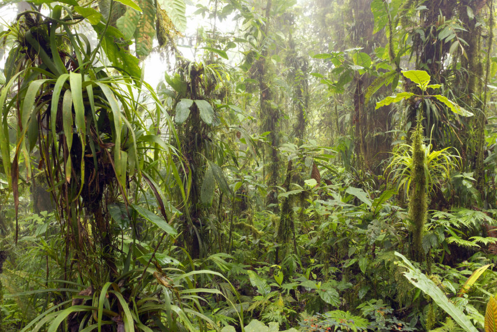
To begin with, almost all visible surfaces are covered in bright green. The forest floor is carpeted with ferns, tree trunks are encased in moss, and epiphytes, orchids, and bromeliads hang from the branches. All of the above is watered on an hourly basis by clouds of fog that float up from the Pacific Ocean and condense into water droplets on the leaves of the trees. The droplets then drip down into the soil and form the basis of the waterways that sustain the life of all animals downstream—humans included.
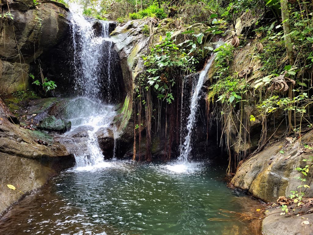
The Camarones River is born from “fog drip” in the cloud forest. The river flows down the coastal mountains and empties out into the Pacific Ocean. If the forest disappears, so does the river. When the river disappears, human settlements collapse.
Moist Seasonal Evergreen Forest
As you descend from the peaks of the coastal cordillera, down into the elevation range of 250-500 meters (820-1,650 feet), you enter into a different kind of forest.
The terminology of this forest deserves a brief explanation. In their seminal 1991 report “Biological Extinction in Western Ecuador,” the famous botanical duo C.H. Dodson and A.H. Gentry referred to the mid-elevational forest of JCR as “moist forest.” This term was also used by the renowned cast of ecologists who authored another seminal report about the Pacific Forest of Ecuador, spearheaded by Conservation International, titled “Status of Forest Remnants in the Cordillera de la Costa.”
A few decades later, a team of national botanists in Ecuador, who were given the mission to classify every single forest type in the country, officially classified JCR’s lowland forest as “seasonal evergreen forest of the Pacific Equatorial coastal mountain range.” This term is certainly more descriptive, but not always practical in conversation. The formal term we prefer is “moist seasonal evergreen forest.” In less formal occasions, we often simply use Dodson and Gentry’s term: “moist forest.”
The “Bamboo House” research station, hidden in the lowland moist forest of the Jama-Coaque Reserve.
The moist forest is an entirely different world than the cloud forest, even though the transition between the two is often less than 75 meters of elevation difference. The vegetation is evergreen like a rainforest, but there’s a wider range of color tones, and the species are different. The trees are actually taller here, relative to the cloud forest. The canopy of the moist forest is formed by big native hardwood trees, some of them reaching heights of 45 meters (150 feet), often with massively buttressed roots.
There is also a wealth of exotic palm trees with spiny trunks and nuts with the color and consistency of ivory, stands of giant bamboo, and countless little streams tumbling down steep slopes, alternating between waterfalls and itty-bitty swimming holes that are naturally stocked with freshwater prawns.
All of this exists under the watchful eyes of loud-mouthed troops of howler monkeys, critically endangered capuchin monkeys, and ocelots that are rarely seen except in pictures taken by infrared trail cameras fitted with motion sensors.
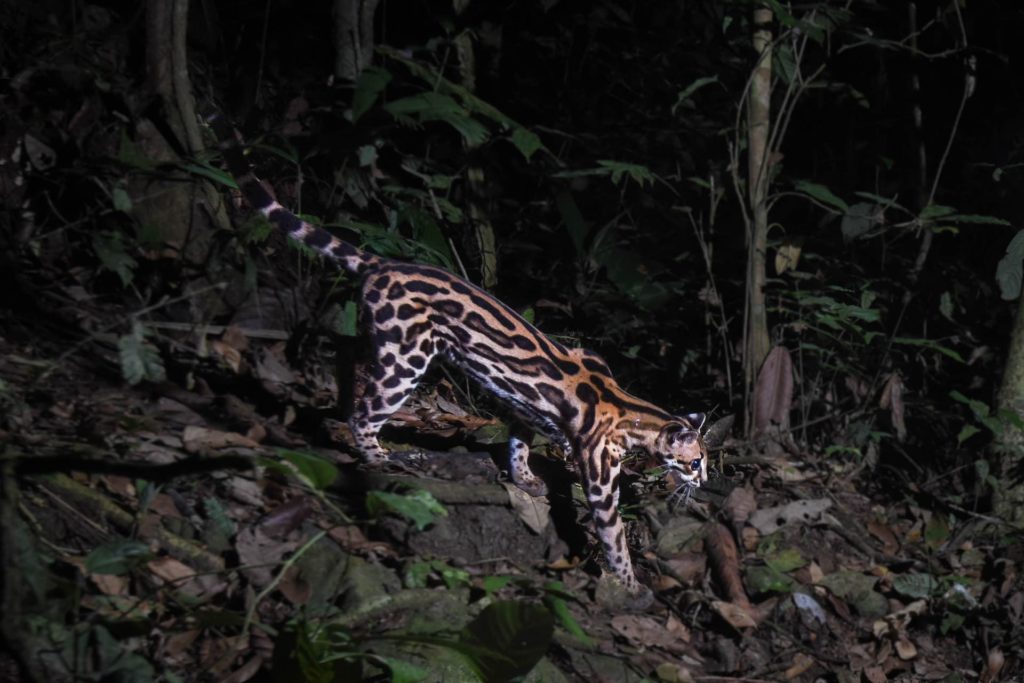
Ocelot captured on a camera trap in the Jama-Coaque Reserve. One of Mother Nature’s great works of biological art.
Tropical Deciduous Forest
If you keep descending the mountain and walk toward the beach—which you can easily do in an afternoon—you may notice that some of the trees are shedding their leaves. You have reached the semi-deciduous forest. Eventually, after another kilometer or two, you stumble into a full-blown deciduous forest. Otherwise known as “tropical dry forest” as well as “Tumbesian dry forest.” The latter term is explained in the next section.
Tropical dry forest at Pacoche in central Manabi.
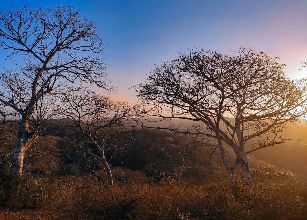
The tropical dry forest looks and functions like a rainforest during the rainy season. But in the dry season, the trees shed all of their leaves. From October until December, the trees are as bare as the North Woods in winter—although not because of temperature. The weather is always tropical. Leaf shedding is entirely a function of precipitation. At the base of the coastal cordillera, rainfall is almost nonexistent for half the year.
But the moment the rainy season begins anew, the dry forest explodes back into life in a matter of days. Imagine compressing all of the life energy of springtime into one or two weeks, and then maintaining this feverish biological pitch for about five months, gradually transitioning into a long and leisurely autumn, without any wintertime. That’s the annual cycle of the tropical dry forest in coastal Ecuador. It is an incredible process to watch unfold.
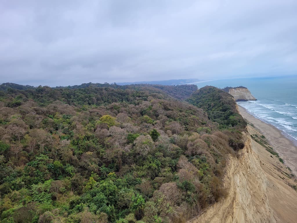
The unprotected 3,400-hectare Cabo Pasado forest, just north of Canoa, is now undergoing real estate development. Here you can see the interplay of tropical dry forest on the ridges (leafless) and semi-deciduous forest in the valleys (still green) during the early stages of the 2021 dry season. (Photo taken by paraglider, courtesy of Peter Stromberg).
It is equally incredible that a tropical dry forest lives just a short walk away from a perpetually wet forest. In northwest Manabí, specifically between Jama and Pedernales, you can literally stand in the cloud forest on the top of the mountain and, looking westward, see a dry forest along the beach.
Because the highway runs along the coast, most motorists who cruise through northern Manabi wrongly assume that tropical dry forest is the dominant vegetation type. They have no idea that a cloud forest looms overhead in the mountains.
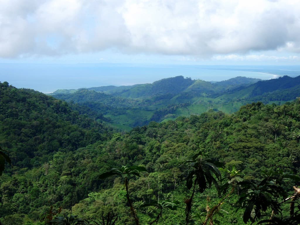
View from the peaks of the coastal cordillera in JCR, facing the beaches of Pedernales in the distance.
Global Biodiversity Hotspot
This brings us to yet another classification that deserves some attention. Just as the vegetation in the coastal Ecuadorian cloud forest is effectively “Chocó rainforest,” the dry forest near the shores of the Pacific ocean is considered “Tumbesian.” This latter term is derived from the so-called Tumbes ecoregion of northern Peru.
The global conservation community has designated a handful of regions throughout the world as “global biodiversity hotspots.” One of them is named the Tumbes-Chocó-Magdalena Biodiversity Hotspot. It describes the wildly dynamic ecoregion that stretches from the ultra-wet Chocó rainforest on the coast of Colombia to the mercilessly deforested Tumbesian dry forests on the northern coast of Peru.
Those two vastly different ecosystems meet and intermingle in coastal Ecuador. But it is precisely in the northwest corner of the province of Manabí where these two extremes come together in a way that doesn’t happen anywhere else in the ecoregion.
 Conservation Priorities
Both in terms of total size and percentage of remaining forest, the Pacific Forest of Ecuador sits at the top of the list of the most endangered tropical forests in the world. Here’s how it compares to a few of its high-profile counterparts.
| Forest | Area of intact forest (km2) | % of original forest remaining |
| Amazon Rainforest | 5,260,000 | 80% |
| Sundaland Forest of Indonesia-Malaysia | 510,000 | 7% |
| Atlantic Forest of Brazil | 99,944 | 8% |
| Madagascar Lowland Forest | 13.452 | 12% |
| Pacific Forest of Ecuador | 510 | 2% |
Although the Pacific Forest is threatened across the length of its entire range, it is at least afforded some degree of protection in the far north and far south. The central section is under the greatest threat.
Northern Section: On paper, the Mache-Chindul Ecological Reserve protects a large swath of coastal Chocó rainforest. It is managed by the national government and, in practice, has suffered from budgetary limitations since its creation in 1996. Much of the land within the legal confines of the reserve is now occupied by farmers and ranchers. In 2019, Mongabay reported that only 61% of the forest in Mache-Chindul Ecological Reserve is still intact. Satellite imagery from 2019 reveals that only 51,000 hectares of contiguous forest are left, the vast majority of which is degraded.
Southern Section: Machalillia National Park protects a large swath of Tumbesian dry forest in addition to semi-deciduous forest and moist forest. Although its officially designated as a national park, the national government only provides support for the protection of the marine area. Forest protection is entirely provided by the well-organized ancestral community of Agua Blanca, which effectively uses ecotourism as a tool for conservation. Satellite imagery from 2019 reveals roughly 77,000 hectares of contiguous forest, although the vast majority of it was previously degraded before the establishment of the national park.
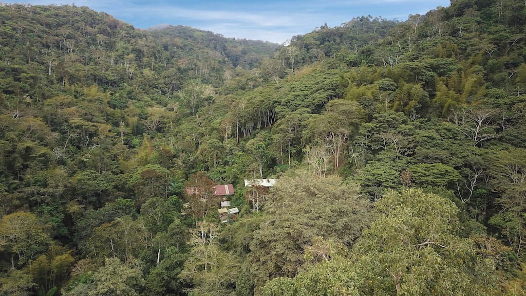
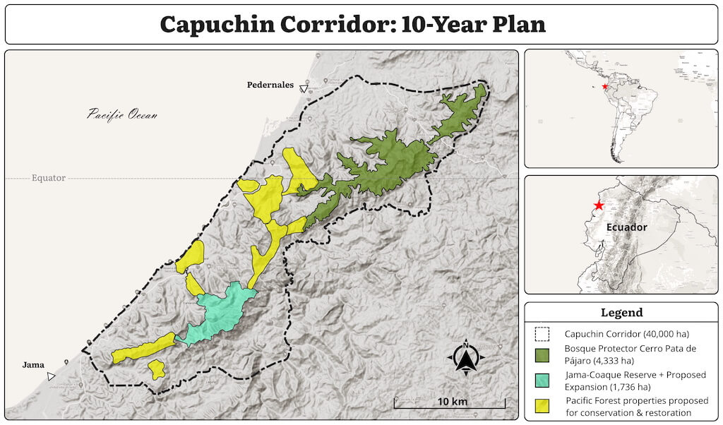
Central Section: The least protected part of the Pacific Forest is the central section: namely, the Tumbes-Chocó transition in northwest Manabí. There is no official government protection of any forest in this region. TMA is protecting the two largest protected areas in this section: the Jama-Coaque Reserve, which currently protects 800 hectares (2,000 acres), and Bosque Protector Cerro Pata de Pájaro.
The Jama-Coaque Reserve (JCR) currently protects 1,192 hectares (2,945 acres). TMA is actively trying to expand JCR by purchasing and protecting an additional 1,000 hectares (roughly 2,450 acres) of forest that is contiguous with the currently protected area. All of this land is owned by absentee landowners who are eager to sell. TMA is actively fundraising to achieve this goal.
Bosque Protector Cerro Pata de Pájaro (PDP) officially spans 4,333 hectares (10,707 acres), which includes 1,000 acres of old growth cloud forest—arguably the most pristine remnant of Pacific Forest left in Ecuador. Yet the rest of its area has suffered substantial deforestation during the decades before and after it was declared a forest preserve. TMA assumed management of PDP in 2022, in partnership with former members of a defunct local conservation organization that first established the struggling reserve in 1995.
Connecting PDP with JCR is the core undertaking of TMA’s Capuchin Corridor project, spanning a 43-kilometer stretch of the coastal cordillera—covering 40,000 hectares (nearly 100,000 acres) of land.
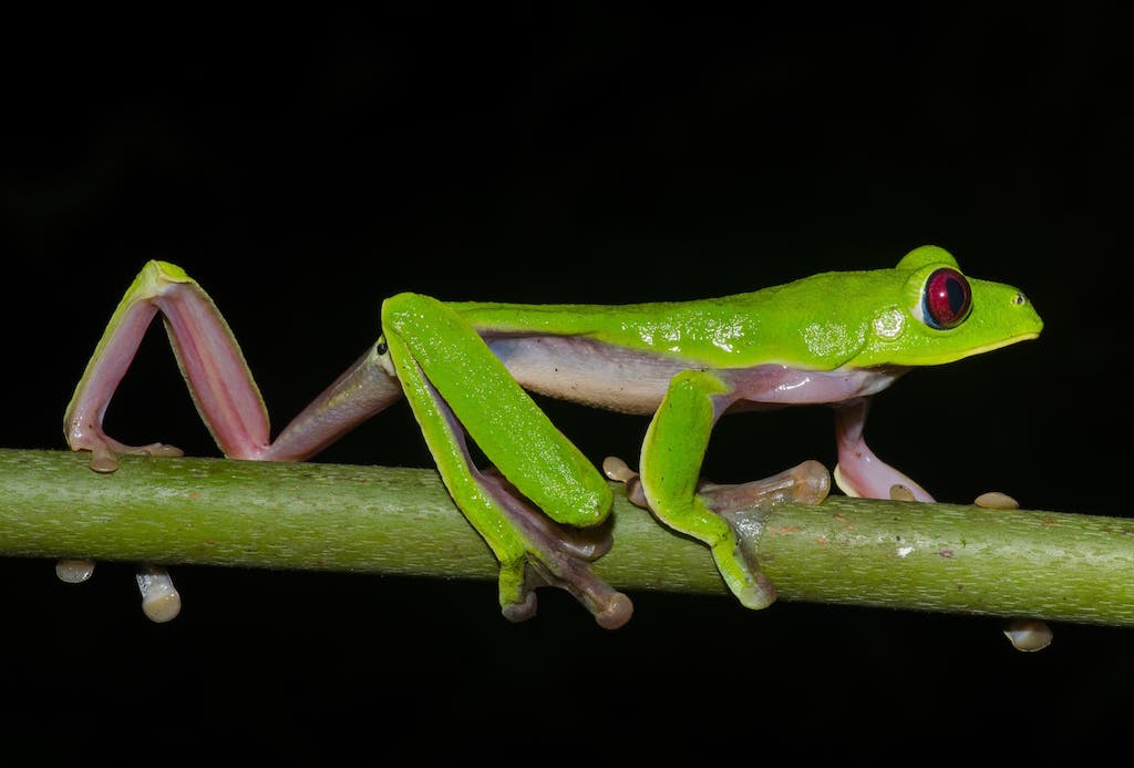
Gliding leaf frog (Agalychnis spurrelli). Photo by Ryan Lynch.
Final Analysis
The Pacific Forest of Ecuador is a name that attempts to describe an ecosystem that defies classification. This kind of thing highlights one of the curious habits of our species. We are constantly trying to categorize our reality, to put everything in tidy little boxes—each one with a label.
But everything in nature exists on a gradient. That’s one of the many lessons that this ecosystem teaches us. The Pacific Forest is a melting pot of tropical ecosystems, a veritable showcase of eccentric forests that aren’t found anywhere else on earth.
This thinly-veiled love letter to this forest is overshadowed by the daunting reality of the present era. At the current rate of deforestation, these forests probably won’t even exist by the time the next generation comes of age. They will be gone from this earth.
It brings to mind an honest question that the children of this generation have already begun to ask their teachers. What does the sixth mass extinction look like?
It looks like this:
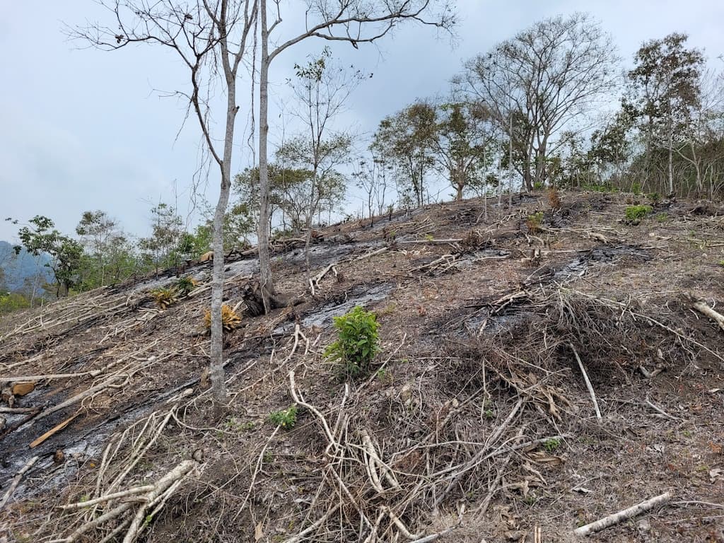
An ordinary afternoon in coastal Ecuador. This much forest is lost every 2 seconds across the planet. Every day of every year.
Is it too late?
No.
As I type these words, sitting on the open-air balcony of the Bamboo House in the middle of the Jama-Coaque Reserve, I am surrounded by wilderness as far as the eye can see. All I can hear is the sound of thousands of different life forms singing in the night air. This great forest has been reduced but it’s not gone. There is still time to protect what is still here and begin the task of restoring what has already been lost.
The same applies to the entire planet.
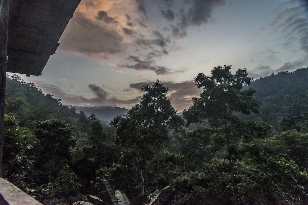
Taken from the balcony of the Bamboo House at dusk.